IAN M

CargoLRAt anchor
Map showing the last known position of IAN M at 18° 47.320' N, 67° 54.025' W
NSEW

Latitude / Longitude

18° 47.320' N
67° 54.025' W

Show in Map
Updated 10 days ago using terrestrial data
Live Satellite · every 5 min

Need more up-to-date positions?

This page shows terrestrial AIS. Download the app for live satellite tracking, refreshed every 5 minutes worldwide.

Get App
At anchor
Current Navigational Status
10.3 kn
Speed
43.0°
/ 43°
Course / Heading
18.1 m
Static Draught
13.9 m
Current Draught
ATD
Mar 29, 2026, 20:33 UTC
ETA
Apr 21, 2026, 13:33 UTC
From
PRINCE RUPERT
To
BALBOA

Voyage Tracker

ATD
20:33 UTCMar 29, 2026
vessel
BALBOAPABLB
ETA
13:33 UTCApr 21, 2026
IAN M

IAN M

Identity

Cargo
Type
LR
Flag
9434773
IMO Number
636015350
MMSI
D5AC6
Call Sign

Specifications

292 m × 45 m
Length × Breadth
2010-01-01
Year Built
179,599 t
Deadweight
93,916 t
Gross Tonnage
N/A
Engine Power
DAEWOO MANGALIA HEAVY INDUSTRIES - MANGALIA, ROMANIA
Builder
BUREAU VERITAS
Class Society
Live tracking · 50,000+ mariners

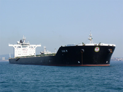
Track IAN M live on MarineRadar

Real-time AIS positions, voyage history, and arrival alerts for IAN M — straight from your phone.

Live AIS positionsVoyage historyArrival alerts
Get the App

4.8 ★ · 3,200 reviews on the App Store.

IAN M — Key Facts

MMSI
636015350
IMO number
9434773
Call sign
D5AC6
Vessel type
Cargo
Flag state
LR
Navigation status
At anchor
Current speed
10.3 knots
Course over ground
43.0°
Heading
43°
Last known position
18.7887°, -67.9004°
Destination
BALBOA
ETA
2026-04-21T13:33:00Z
Departure port
PRINCE RUPERT
Actual time of departure
2026-03-29T20:33:00Z
Current draught
13.9 m
Maximum static draught
18.1 m
Year built
2010-01-01
Gross tonnage
93916
Dead weight
179599 t
AIS last updated
2026-04-26T13:42:00Z