Live Vessel Tracking Map
About the Live Vessel Tracking Map
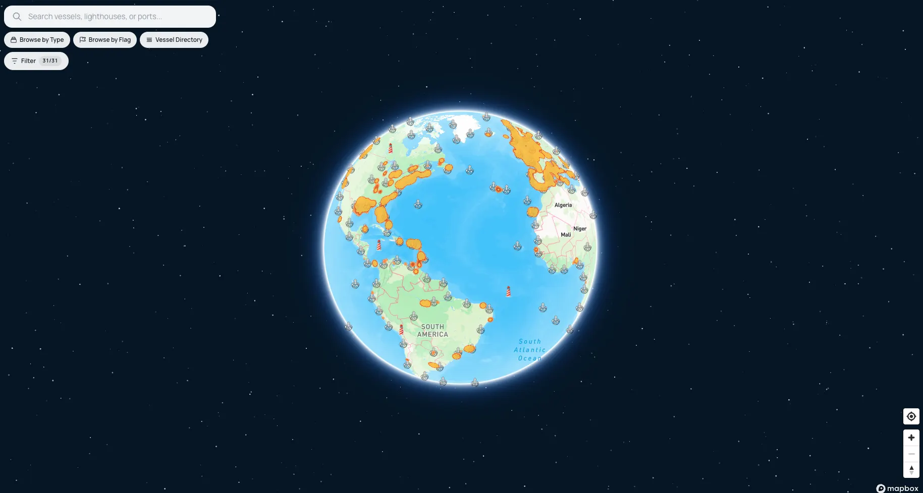
The map above shows live AIS positions for 112,000+ ships across every ocean. Use the search to find any vessel by name, MMSI, or IMO number, then click its marker to open the full record — current position, speed, course, destination, dimensions, and voyage history. You can also tap any port or lighthouse marker to jump to its detail page, or pan to a region to see everything moving through it.
How fresh is the data? AIS transponders broadcast position, course, and speed at intervals from every 2 seconds (fast-moving ships) to every 3 minutes (vessels at anchor). Near the coast, terrestrial receivers pick these up within seconds; far offshore, satellite passes relay them within minutes to tens of minutes. The map refreshes positions continuously as new broadcasts arrive.
Frequently Tracked Vessels
- MSC IRINA — Other, LR
- MISS CHIEF — Pleasure Craft, CA
- VICTORY VI — Tug, CA
- SPIRIT OF YALIS — Passenger, CA
- ILFRACOMBE PRINCESS — Passenger, GB
- ISLAND AURORA — Passenger, CA
- CAPTAIN RED — Unknown, US
- MSC JULIA R. — Cargo, LR
- CAROLINE BEZENGI — Tanker, CM
- ECUADOR L — Cargo, LR
- KHADIJAH 01 — Cargo, BO
- BLUE SKY 4 — Cargo, KM
- DADMAN 3 — High-Speed Craft, IR
- SABOOR 2 — Fishing, IR
- OMIDAN 3 — Tug, IR
- AYA — Cargo, MT
- CHRISTINA V — Other, LR
- STARDUST — Cargo, MH
- SAINT MYRON — Cargo, MT
- BERN — Cargo, MH
Browse by Ship Type
Looking for a class of vessel rather than one ship? Browse the fleet by category: tankers, cargo & container ships, cruise & passenger ships, fishing vessels, yachts, and all eight AIS categories. Or explore by flag state to see every ship registered under a given country.
More Maritime Data
The vessels directory lists every tracked ship with search by name, MMSI, and IMO. The ports directory covers 20,559 ports with arrivals, departures, and harbor particulars, and the lighthouses directory documents 14,900+ lights with characteristics and ranges.