
Track MANFU I live on MarineRadar
Real-time AIS positions, voyage history, and arrival alerts for MANFU I — straight from your phone.
Similar Vessels
Nearby vessels of the same type
Explore related maritime data
Dive into the fleet, port, and flag state that MANFU I is part of.
About MANFU I
Identity · Ownership · Class · Route
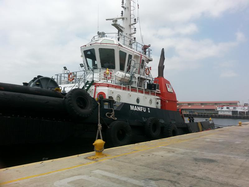
MANFU I — Tug
Built in 2011, with a gross tonnage of 472 GT, and a dead weight of 306 tonnes, MANFU I is a tug registered under the Colombia flag. The vessel is owned by SERVIPORT - CARTAGENA, COLOMBIA, built by YUEXIN SHIP INDUSTRY - GUANGZHOU, CHINA.
MANFU I route and voyage history
MANFU I is currently on a voyage from CARTAGENA to CARTAGENA with an estimated arrival on 2026-06-23T11:57:00Z. The live route and current course of MANFU I are shown on the bridge map above, updated whenever the vessel is in range of a coastal AIS receiver or a satellite pass. View MANFU I's full route replay to see voyage history, course changes, and port-by-port movement.
Vessel class and identifiers
Vessels in the same class as MANFU I can be seen in the Similar Vessels section above or in the full tug fleet at /vessel-type/tug-pilot-vessel.