Antarctica flag

CAP HORN IFishing · IMO 9246968

AQStopped
World map showing the last known position of CAP HORN I at 20° 56.355' S, 55° 17.144' E
NSEW

Latitude / Longitude

20° 56.355' S
55° 17.144' E

Show in Map
Updated 49 minutes ago using terrestrial data
Live Satellite · every 5 min

Need more up-to-date positions?

This page shows terrestrial AIS. Download the app for live satellite tracking, refreshed every 5 minutes worldwide.

Get App
Stopped
Current Navigational Status
0.0 kn
Speed
73.0°
/ 188°
Course / Heading
5 m
Static Draught
5 m
Current Draught
ATD
Sep 9, 2025, 13:05 UTC
ETA
Nov 21, 2025, 11:01 UTC
From
REUNION
To
REUNION

Voyage Tracker

Réunion flag
REUNIONREREU
ATD
13:05 UTCSep 9, 2025
Réunion flag
REUNIONREREU
ETA
11:01 UTCNov 21, 2025
CAP HORN I

CAP HORN I

Identity

Fishing
Type
Antarctica flagAQ
Flag
9246968
IMO Number
635221000
MMSI
FQBI
Call Sign

Specifications

60 m × 10 m
Length × Breadth
2002-01-01
Year Built
N/A
Deadweight
1,295 t
Gross Tonnage
N/A
Engine Power
CHANTIER PIRIOU FRERES - CONCARNEAU, FRANCE
Builder
BUREAU VERITAS
Class Society
Live tracking · 50,000+ mariners

Track CAP HORN I live on MarineRadar

Real-time AIS positions, voyage history, and arrival alerts for CAP HORN I — straight from your phone.

Live AIS positionsVoyage historyArrival alerts
Get the App

4.6 ★ · 18,000 reviews

Dive into the fleet, port, and flag state that CAP HORN I is part of.

Flag State
All AQ-flagged vessels
Browse every ship currently registered under the AQ flag, with live AIS positions.
Vessel Type
Browse all Fishings
See the global fleet of fishings tracked on MarineRadar with live AIS data.
Departure Port
Port of REUNION
Port traffic, arrivals and live vessel positions for REUNION (REREU).

About CAP HORN I

Identity · Ownership · Class · Route

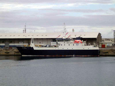
CAP HORN I — Fishing

Built in 2002, with a gross tonnage of 1,295 GT, CAP HORN I is a fishing registered under the Antarctica flag. The vessel is owned by CAP BOURBON - LE PORT, REUNION ISLANDS, built by CHANTIER PIRIOU FRERES - CONCARNEAU, FRANCE.

CAP HORN I route and voyage history

CAP HORN I is currently on a voyage from REUNION to REUNION with an estimated arrival on 2025-11-21T11:01:00Z. The live route and current course of CAP HORN I are shown on the bridge map above, updated whenever the vessel is in range of a coastal AIS receiver or a satellite pass. View CAP HORN I's full route replay to see voyage history, course changes, and port-by-port movement.

Vessel class and identifiers

CAP HORN I is classed by BUREAU VERITAS, which inspects the vessel against its safety and structural rules. Vessels in the same class as CAP HORN I can be seen in the Similar Vessels section above or in the full fishing fleet at /vessel-type/fishing.

  • MMSI: 635221000
  • IMO: 9246968
  • Call sign: FQBI
  • Vessel type: Fishing
  • Flag state: Antarctica

Frequently Asked Questions

What are the identifiers for CAP HORN I?+
CAP HORN I broadcasts MMSI 635221000 and is registered as IMO 9246968, with call sign FQBI . The MMSI is the radio identifier used by AIS; the IMO number stays with the ship for life and does not change with re-flagging or sale.
What type of ship is CAP HORN I?+
CAP HORN I is classified as a fishing vessel registered under the AQ flag. The vessel-type classification is derived from the AIS Type field broadcast by the ship's transponder; full fishing fleet at /vessel-type/fishing and full AQ flag list at /flag/aq.
How can I see the live position of CAP HORN I?+
MarineRadar shows the latest AIS broadcast from CAP HORN I above, with current position, course, speed, and navigation status. Tap "View on map" to centre the live tracker on the vessel and watch its movement update in real time. The same data is available offline-friendly in the iOS and Android apps.
How often is CAP HORN I's position updated?+
AIS transponders broadcast position every 2 seconds when underway at high speed and up to every 3 minutes at anchor. The position you see refreshes whenever the ship is in range of a coastal AIS receiver or a satellite pass — typically seconds in coastal waters and minutes offshore.
What class is CAP HORN I?+
CAP HORN I is classed by BUREAU VERITAS, the classification society responsible for inspecting the vessel against safety, structural and operational rules. As a fishing, CAP HORN I sits in the same design class as the other fishings listed in the Similar Vessels section of the vessel page, or in the full fishing directory at /vessel-type/fishing. CAP HORN I has a gross tonnage of 1,295 GT.

CAP HORN I — Key Facts

MMSI
635221000
IMO number
9246968
Call sign
FQBI
Vessel type
Fishing
Flag state
AQ
Navigation status
Stopped
Current speed
0.0 knots
Course over ground
73.0°
Heading
188°
Last known position
-20.9392°, 55.2857°
Destination
REUNION
ETA
2025-11-21T11:01:00Z
Departure port
REUNION
Actual time of departure
2025-09-09T13:05:00Z
Current draught
5 m
Maximum static draught
5 m
Year built
2002-01-01
Gross tonnage
1295
Dead weight
0 t
AIS last updated
2026-06-23T12:59:00Z