HUNTER M
TugUSMooredIMO 9457311MMSI 367402050
Latitude / Longitude
29° 59.764' N
93° 56.809' W
Updated 807 days ago using terrestrial data
Live Satellite · every 5 min
Need more up-to-date positions?
This page shows terrestrial AIS. Download the app for live satellite tracking, refreshed every 5 minutes worldwide.
Get App
Moored
Current Navigational Status
0.0 kn
Speed
147.3°
/ 109°
Course / Heading
6 m
Static Draught
5.8 m
Current Draught
ATD
Apr 13, 2026, 19:42 UTC
ETA
Apr 13, 2026, 19:58 UTC
From
FREEPORT
To
FREEPORT
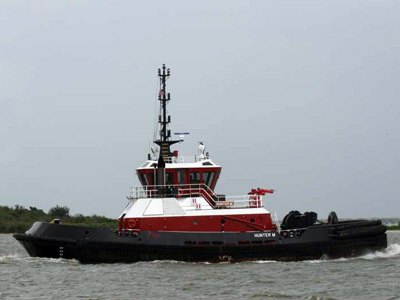
HUNTER M
Identity
Tug
Type
Flag
9457311
IMO Number
367402050
MMSI
WDE8140
Call Sign
Specifications
32 m × 14 m
Length × Breadth
N/A
Year Built
N/A
Deadweight
N/A
Gross Tonnage
N/A
Engine Power
N/A
Builder
N/A
Class Society
Similar Vessels
HUNTER M — Key Facts
- MMSI
- 367402050
- IMO number
- 9457311
- Call sign
- WDE8140
- Vessel type
- Tug
- Flag state
- US
- Navigation status
- Moored
- Current speed
- 0.0 knots
- Course over ground
- 147.3°
- Heading
- 109°
- Last known position
- 29.9961°, -93.9468°
- Destination
- FREEPORT
- ETA
- 2026-04-13T19:58:00Z
- Departure port
- FREEPORT
- Actual time of departure
- 2026-04-13T19:42:00Z
- Current draught
- 5.8 m
- Maximum static draught
- 6 m
- Dead weight
- 0 t
- AIS last updated
- 2024-02-16T14:41:49Z