ENDEAVOR
OtherUSMooredIMO 7604300MMSI 303471000
Latitude / Longitude
25° 57.900' N
97° 21.559' W
Updated 47 days ago using terrestrial data
Live Satellite · every 5 min
Need more up-to-date positions?
This page shows terrestrial AIS. Download the app for live satellite tracking, refreshed every 5 minutes worldwide.
Get App
Moored
Current Navigational Status
0.0 kn
Speed
82.0°
/ 72°
Course / Heading
0 m
Static Draught
3.1 m
Current Draught
ATD
Sep 18, 2025, 13:36 UTC
ETA
Mar 16, 2026, 08:00 UTC
From
HALIFAX
To
BROWNSVILLE
Voyage Tracker
ATD13:36 UTCSep 18, 2025
Mar 16, 202608:00 UTCETA
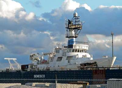
ENDEAVOR
Identity
Other
Type
Flag
7604300
IMO Number
303471000
MMSI
WCE5063
Call Sign
Specifications
60 m × 10 m
Length × Breadth
N/A
Year Built
N/A
Deadweight
N/A
Gross Tonnage
N/A
Engine Power
N/A
Builder
N/A
Class Society
Live tracking · 50,000+ mariners
Track ENDEAVOR live on MarineRadar
Real-time AIS positions, voyage history, and arrival alerts for ENDEAVOR — straight from your phone.
Live AIS positionsVoyage historyArrival alerts
Get the AppiOS · Android
4.8 ★ · 3,200 reviews on the App Store.
ENDEAVOR — Key Facts
- MMSI
- 303471000
- IMO number
- 7604300
- Call sign
- WCE5063
- Vessel type
- Other
- Flag state
- US
- Navigation status
- Moored
- Current speed
- 0.0 knots
- Course over ground
- 82.0°
- Heading
- 72°
- Last known position
- 25.9650°, -97.3593°
- Destination
- BROWNSVILLE
- ETA
- 2026-03-16T08:00:00Z
- Departure port
- HALIFAX
- Actual time of departure
- 2025-09-18T13:36:00Z
- Current draught
- 3.1 m
- Maximum static draught
- 0 m
- AIS last updated
- 2026-03-17T22:37:00Z