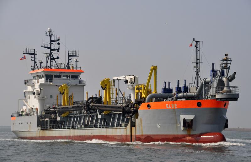
ELBE
DredgerNLRestricted manoeuverabilityIMO 9452842MMSI 245272000
Latitude / Longitude
43° 36.500' S
172° 45.610' E
Updated 2 days ago using terrestrial data
Live Satellite · every 5 min
Need more up-to-date positions?
This page shows terrestrial AIS. Download the app for live satellite tracking, refreshed every 5 minutes worldwide.
Get App
Restricted manoeuverability
Current Navigational Status
2.0 kn
Speed
204.0°
/ 158°
Course / Heading
4.2 m
Static Draught
4.2 m
Current Draught
ATD
Apr 10, 2026, 07:05 UTC
ETA
Apr 29, 2026, 14:55 UTC
From
TAURANGA
To
TAURANGA
ELBE
Identity
Dredger
Type
Flag
9452842
IMO Number
245272000
MMSI
PBMK
Call Sign
Specifications
N/A
Length × Breadth
N/A
Year Built
N/A
Deadweight
N/A
Gross Tonnage
N/A
Engine Power
N/A
Builder
N/A
Class Society
Live tracking · 50,000+ mariners
Track ELBE live on MarineRadar
Real-time AIS positions, voyage history, and arrival alerts for ELBE — straight from your phone.
Live AIS positionsVoyage historyArrival alerts
Get the AppiOS · Android
4.8 ★ · 3,200 reviews on the App Store.
ELBE — Key Facts
- MMSI
- 245272000
- IMO number
- 9452842
- Call sign
- PBMK
- Vessel type
- Dredger
- Flag state
- NL
- Navigation status
- Restricted manoeuverability
- Current speed
- 2.0 knots
- Course over ground
- 204.0°
- Heading
- 158°
- Last known position
- -43.6083°, 172.7602°
- Destination
- TAURANGA
- ETA
- 2026-04-29T14:55:00Z
- Departure port
- TAURANGA
- Actual time of departure
- 2026-04-10T07:05:00Z
- Current draught
- 4.2 m
- Maximum static draught
- 4.2 m
- AIS last updated
- 2026-05-04T01:49:55Z